A Warm Fall in Jackson… But Big Changes Are Coming
It’s been a stunningly warm and golden fall across Jackson Hole. Bluebird skies, crisp mornings, and hardly a hint of early snow. But according to the Climate Prediction Center, that’s about to change in a big way.
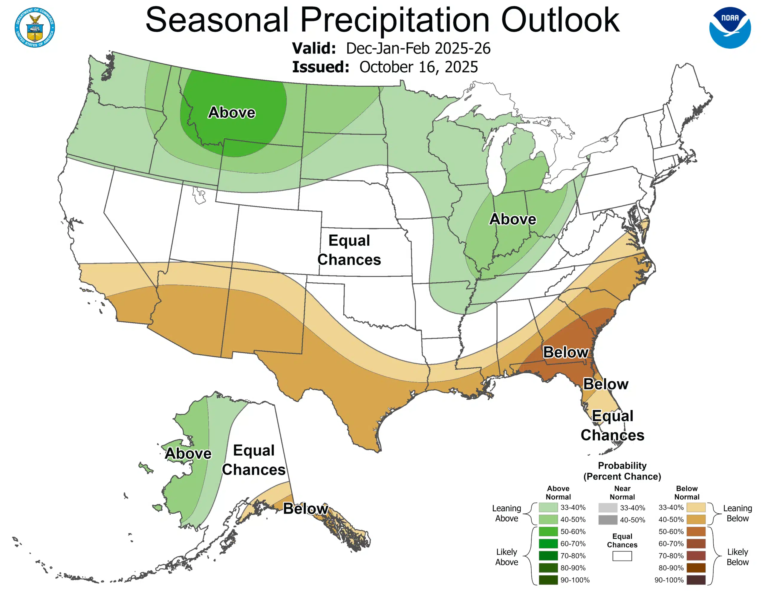
A weak La Niña pattern has officially taken hold. It is expected to persist through the winter months, bringing a classic northern Rockies setup: above-normal precipitation for northwest Wyoming, including Jackson Hole. In plain terms, the odds favor a snowier, wetter winter ahead.
What the Official Outlook Says
The CPC confirms that a weak La Niña is already underway and is favored to persist through December 2025 – February 2026, with about a 55% chance of transitioning to ENSO-neutral in January-March 2026.
For the U.S. winter (Dec–Feb) outlook:
Precipitation: Elevated odds for above-normal precip across the Pacific Northwest, northern Rockies, northern Plains, and western Great Lakes.
Temperature: Much of the northern tier shows “Equal Chances” for above/near/below normal; the South leans warmer.
For Wyoming Specifically: The forecast suggests that northwest Wyoming, including the Jackson Hole area, falls into the “above-normal precipitation” zone.
Winter 2025-26 & Jackson Hole: What to Watch
A wetter storm track is more likely this winter in the Northern Rockies, meaning the Tetons area can expect increased chances of storms and snowfall, especially in active periods.
The “Equal Chances” temperature outlook means cold snaps are still very possible, even if the season as a whole isn’t guaranteed colder than average.
For tourism, ski resorts, ski patrol, and avalanche safety: The combination of above-normal precipitation odds + mountain terrain means there’s a higher chance of significant snowfall runs, increased avalanche cycles, and potential travel/chain-control events for mountain passes.
For water & watershed planning (Upper Snake / Teton Basin): More precipitation is a positive sign for snowpack and spring runoff.